Luperon, Dominican Republic (DR) to Marina Puerto Bahia, Samana’, DR
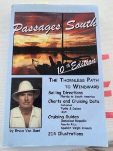
“The Bible” for sailing The Thorny Path
Our stay in Luperon was brief, only a couple of days. The process of checking into the DR and checking out was quite cumbersome. To check-in the Commandante’, a member of the DR Armada (Navy), came aboard and completed initial paperwork, including taking our photos. We then had to go ashore to the Immigration Office, then next door to Customs, and return the next day to check-in with Agriculture. So, four “official” visits for the check-in process. Since we planned to be in Luperon briefly and leave by 6:00 am on day #3, we had to start the check-out process the same day we visited Agriculture to complete the check-in process. Immigration, Customs, and Agriculture are in the same small compound. Literally 3 hours after completing check-in, we started the check-out process. We went back to Customs for our first step in the check-out process, then Agriculture, and finally back to the Armada (Navy) Office. By 5:00 pm on day #2 our departure paperwork was done, and the Navy representative gave us our Despacho, the official “you can now leave this port paperwork”. On our way out of Luperon Bay the next morning around 5:30am, we were approached by what we thought was a fishing boat. The boat pulled up beside us and asked to see our Despacho. Linda retrieved the Despacho and while still underway (but just barely moving) they took her photo holding up our departure paperwork!
The north coast of the DR is considered one of the most difficult places on the planet to sail east. The trade winds are almost constant and strong, blowing east to west and there are many large shoals in the Atlantic off the DR coast. Additionally, the Antilles Current runs from the NE at 0.5 – 2.0 knots along the DR’s northern coast (If you’ve ever ridden a bicycle uphill against the wind, that’s what this is like.). On top of that there are 4 capes to clear, where wind, waves, swell, and current are accelerated. It all adds up to a very difficult stretch of ocean to negotiate by sailboat, or any small boat for that matter. It is such a notorious part of most sailors’ paths to the heart of the Caribbean from the U.S. mainland that it’s been given the nickname “The Thorny Path”. Most boaters have a copy of Bruce Van Sant’s book, The Gentleman’s Guide to Passages South, (The Thornless Path To Windward) onboard. Van Sant’s book has been in publication for decades, has been updated regularly, and is considered “the Bible” for sailing the Thorny Path.
For the northern coast of the DR from Luperon to Samana’ (our destination) Van Sant recommends making 3 hops along the coast at night. Most days, in late evening, 9:00 pm – 11:00pm, the “night lee” sets in along the coast. After the warm air over the DR landmass has built during the day it causes an offshore breeze at night. Also, the Tradewinds usually drop. The combination settles the seas and boaters can motor to windward more comfortably, but still into chop and wind on the nose, though much less than during the day. The night lee starts to dissipate by 9:00 am, so it’s a short window by cruisers’ standards to get from one anchorage to the next. There are 3 suitable anchorages along the north coast, but all are subject to swell and wind shifts. When talking to other cruisers about the passage, the first question asked every time was: “Do you have Van Sant’s book?”. Yes.
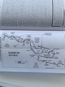
One of Van Sant’s helpful “chartlets”
Although Van Sant recommends taking advantage of the night lee, he also says that the passage can be completed mostly in daylight by leaving from each anchorage before dawn – if your boat is fast enough. Most cruisers heading for Samana’ try to make the transit over 3 nights.
Night #1: Luperon to Rio San Juan (clearing Cabo Macoris),
Night #2: Rio San Juan to Escondido also known as Puerto El Valle (clearing Cabo Frances Viejo), and
Night #3: Escondido to Samana’ (clearing Cabo Cabron and Cabo Samana’)
For most sailboats the first two anchorages are 9 -12 hours apart with the final leg taking about 6 – 8 hours. Each anchorage is close to one of several capes along the north coast. As mentioned, the capes accelerate winds, cause the seas to build, and create a “washing machine” with swell coming from 2, 3, or 4 different directions. So, the earlier one rounds the capes, the better. There is an intermediate anchorage, Sosua, midway between Luperon and Rio San Juan. Linda and I decided rather than sailing from Luperon to Rio San Juan, we would stop at Sosua – it was a good decision. By “adding” another anchorage our first two days were short. We left at sunrise and had our anchor down by 11:00 each day. For the Rio San Juan to Escondido leg, we left Rio San Juan just after 3:00am and had our anchor down just after noon. Van Sant warns that the winds and seas pick up quickly after 9:00am. Although we couldn’t make his 9:00 am deadlines, we didn’t experience rough conditions, we had easy motoring all the way. One advantage we have is that for a catamaran we have powerful engines, two 57HP diesels. Most catamarans our size have two 39HP diesels. Our extra power gives us more speed through rough water and strong currents. If you are wondering why we chose daylight passages, that’s a good question. Local fishermen put out fish traps along the coast. We’d heard several accounts of these traps getting caught in boat propellers and causing anything from chaos to significant damage. With our engines, we felt we could opt for early morning departures and still make it to the anchorages before the conditions got too uncomfortable. This would have us traveling mostly during daylight so we could keep watch for any fish trap hazards along the way. We did see 6 during our 4 days of passages.
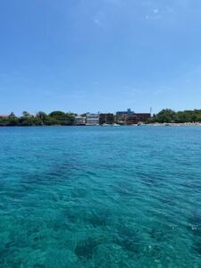
Sosua
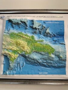
A relief map showing the large shoals north of the DR.
We had one mishap along the way. At Rio San Juan we were not happy with the set of our anchor. I dove on the anchor and asked Linda to start the engines and reverse them to check the set. I forgot we had our mermaid line out. A mermaid line is a floating line attached to a buoy, floating behind the boat to let other boaters know a swimmer is in the water. Also, if current sweeps the swimmer away from the boat (the current will run from the bow to the stern), there’s a line to swim for. The mermaid line is a way to make your boat “longer”, so the swimmer has something to grab if sweep down current. Linda didn’t think about the line either. As she backed down on the anchor, the line got wrapped around the port prop. Linda realized what had happened and shut both engines down quickly. It took a few minutes to unwrap, and the prop chewed up 20 feet of our 82-foot line, but no real damage was done. We were really kicking ourselves. Never engage an engine with a line in the water is “Boating 101”, a rule we had never broken in more than 30 years of boating. It was my fault as I told Linda to back down on the anchor without thinking things through all the way.
Although all the north-side anchorages were nice, our next stop, Escondido, was the most spectacular anchorage we’ve ever experienced. High rocky cliffs, surrounded by mountains rising from the water, palm trees, and a beautiful sandy beach. Once anchored at Escondido we understood its other name, Puerto El Valle. It felt as though we were anchored in a valley, with rock cliffs 200 – 400 ft. high to our port side, a low sandy beach on our bow, and lush green mountains on our starboard side, with palm trees everywhere! There was even a big cave in the middle of the beach. Wow, what a place! Although the Bahamas are beautiful islands, and the water is incredible, the Dominican Republic is much more spectacular, and varied.
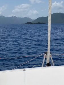
Approaching Escondido
We left Escondido about 4:00am in pitch darkness. This was necessary to round the last two capes before the trade winds kicked up. It was so dark that we couldn’t see the cliffs only a few hundred feet to our starboard side. The last leg to Samana’ is the shortest, only about 40nm; however, there are two capes to clear, Cabo Cabron and Cabo Samana’. In clearing Cabo Cabron we experienced the roughest conditions on the DR’s north coast (which we anticipated). It was truly a washing machine. Large swells from numerous directions as the current, waves, wind, and land all came together. Many large swells were reflecting out to sea off the rocky coast. Often opposing swells would smack together creating a geyser of water and foam. There was no reading the water, just plowing ahead. Luckily in a couple of hours both capes were behind us, and we entered the Bay of Samana’. By lunch we were at Marina Puerto Bahia, all refueled and tied up in a slip. We had started following a disturbance in the Atlantic, which would eventually be named Bret, and decided to wait the storm out in the marina.
The north coast of the DR was every bit the challenge we had heard. Next comes the Mona Passage, between the DR and Puerto Rico. The Mona Passage has many of the same elements of the coast we just motored through, but it’s a straight shot with no anchorages. Once Bret passes, we think we’ll have a 48 hour window. Our next destination? St. Croix, USVI.
Leave a Reply